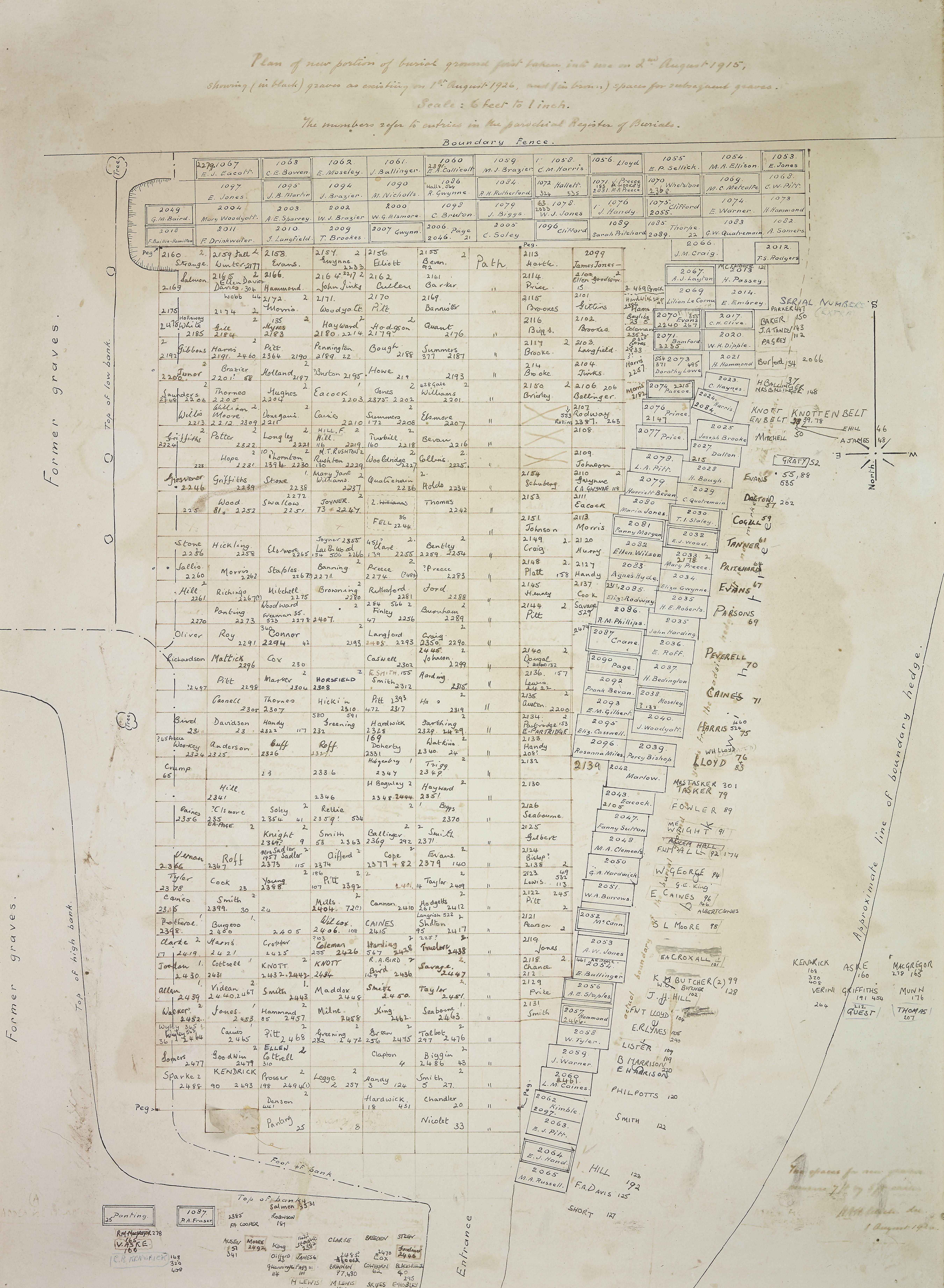
West Malvern Churchyard
1915-1926 burial map
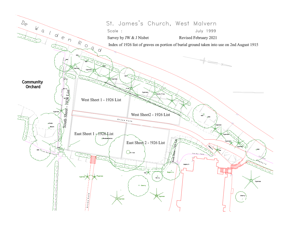
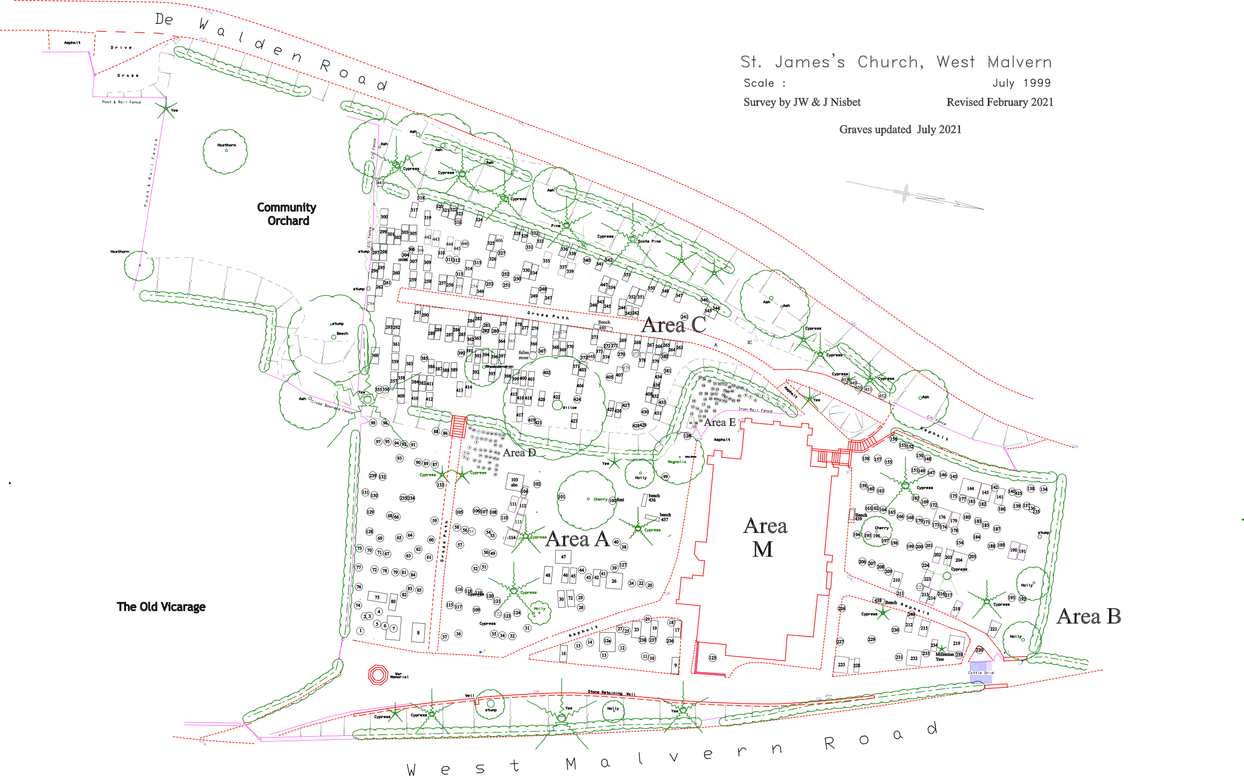
This map covers Areas C and E (see above) and shows burials as opposed to grave markers. Descriptors used to indicate approximate location:
- 1926CSouth - south section of Area C
- 1926CWest - west section of Area C (west of grass path)
- 1926CEast - east section of Area C (east of grass path)
- 1926E - section covering Area E